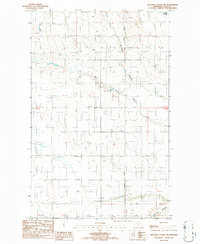
1986 Map of Antelope Coulee SW
USGS Topo · Published 1986About this map
West Fork Willow Creek and Antelope Coulee define the drainage of this Toole County landscape, where the High Plains topography is marked by distinctive Alkali Flats and seasonal watercourses. The 1980s infrastructure of the region is evident through the presence of a Pumping Station and buried utility lines marked simply as Pipe. The land is surveyed against the Principal Meridian, showcasing the precise township and range grid that organized Montana's agricultural and resource-rich northern tier. This provisional survey captures the intersection of natural coulee systems and modern utility corridors, providing a clear record of the area's physical development during the late twentieth century.
Find a feature on this map
10 named features on this map. Tap any name to fly to it.
Don’t see what you’re looking for? This feature index may not catch every label — zoom into the map to look around manually.
Map Details
Editions of this 1986 Antelope Coulee SW Map
This is the sole edition of this map. No revisions or reprints were ever made.
Other maps of this area

1920 · Conrad
USGS Topo · 1:125,000

1943 · Antelope Coulee
USGS Topo · 1:62,500

1943 · Shelby
USGS Topo · 1:62,500

1954 · Shelby
USGS Topo · 1:250,000

1958 · Shelby
USGS Topo · 1:250,000

1967 · Naismith
USGS Topo · 1:24,000

1967 · South Devon School
USGS Topo · 1:24,000

1967 · Dunkirk
USGS Topo · 1:24,000
1984 · Conrad
USGS Topo · 1:100,000

1984 · Sweet Grass Hills
USGS Topo · 1:100,000