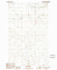
1986 Map of Antelope Coulee NW
USGS Topo · Published 1986About this map
The Principal Meridian bisects this high-plains landscape in Toole County, anchoring a terrain defined by deep erosional drainage patterns. The map showcases the intricate winding paths of Antelope Coulee, Fifteenmile Coulee, and Black Coulee as they cut through the dry northern Montana benchland. This 1980s provisional survey highlights the region's agricultural infrastructure, marking the locations of Grain Bins and a facility named Pioneer near the western edge. Settlement is sparse, represented by isolated structures and a small Cem located on the high ground between the drainage basins. The survey provides an exacting look at the section lines and township boundaries that partitioned the Montana Territory, showing how the land was organized for dryland farming and ranching north of Shelby.
Find a feature on this map
11 named features on this map. Tap any name to fly to it.
Don’t see what you’re looking for? This feature index may not catch every label — zoom into the map to look around manually.
Map Details
Editions of this 1986 Antelope Coulee NW Map
This is the sole edition of this map. No revisions or reprints were ever made.
Other maps of this area

1939 · Sunburst
USGS Topo · 1:62,500

1943 · Antelope Coulee
USGS Topo · 1:62,500

1943 · Shelby
USGS Topo · 1:62,500

1945 · West Butte
USGS Topo · 1:62,500

1954 · Shelby
USGS Topo · 1:250,000

1958 · Shelby
USGS Topo · 1:250,000

1984 · Sweet Grass Hills
USGS Topo · 1:100,000
1986 · Antelope Coulee SW
USGS Topo · 1:24,000
1986 · Shelby
USGS Topo · 1:24,000
1986 · Ferdig
USGS Topo · 1:24,000