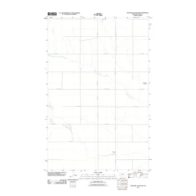
2011 Map of Antelope Coulee SW
USGS Topo · Published 2011About this map
West Fork Willow Creek winds across this section of Toole County, carving a path through the high plains of northern Montana. The landscape is defined by a grid of rural roads, including Gumboe Joe Rd and Jap Evans Rd, which connect isolated homesteads and ranching operations. The Frandsen Ranch stands as a primary point of settlement in the southern portion of the quadrangle, reflecting the enduring agricultural character of the region. Water management is critical in this arid environment, evidenced by the presence of Lipton Dam and the distinct geographic depression of Antelope Coulee. The mapping shows the systematic organization of the territory into large parcels, intersected by the long stretch of N Dunkirk Rd as it moves toward the horizon.
Find a feature on this map
10 named features on this map. Tap any name to fly to it.
Don’t see what you’re looking for? This feature index may not catch every label — zoom into the map to look around manually.
Map Details
Editions of this 2011 Antelope Coulee SW Map
This is the sole edition of this map. No revisions or reprints were ever made.
Other maps of this area

1920 · Conrad
USGS Topo · 1:125,000

1943 · Antelope Coulee
USGS Topo · 1:62,500

1943 · Shelby
USGS Topo · 1:62,500

1954 · Shelby
USGS Topo · 1:250,000

1958 · Shelby
USGS Topo · 1:250,000

1967 · Naismith
USGS Topo · 1:24,000

1967 · South Devon School
USGS Topo · 1:24,000

1967 · Dunkirk
USGS Topo · 1:24,000
1984 · Conrad
USGS Topo · 1:100,000

1984 · Sweet Grass Hills
USGS Topo · 1:100,000