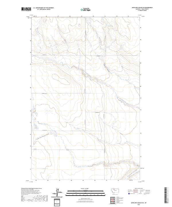
2024 Map of Antelope Coulee SW
USGS Topo · Published 2024About this map
Dunkirk Coulee and its tributaries carve a network of drainages across this northern Toole County landscape, where the high plains terrain is defined by water-sculpted coulees. The West Fork Willow Creek flows diagonally through the center of the sheet, joining the broader northern Montana drainage system alongside the North Fork Dunkirk Coulee and Antelope Coulee. This is a predominantly rural and industrial section of the state, indicated by the presence of a Compressor station and a sparse grid of country roads.
Find a feature on this map
14 named features on this map. Tap any name to fly to it.
Don’t see what you’re looking for? This feature index may not catch every label — zoom into the map to look around manually.
Map Details
Editions of this 2024 Antelope Coulee SW Map
This is the sole edition of this map. No revisions or reprints were ever made.
Other maps of this area

1920 · Conrad
USGS Topo · 1:125,000

1943 · Antelope Coulee
USGS Topo · 1:62,500

1943 · Shelby
USGS Topo · 1:62,500

1954 · Shelby
USGS Topo · 1:250,000

1958 · Shelby
USGS Topo · 1:250,000

1967 · Naismith
USGS Topo · 1:24,000

1967 · South Devon School
USGS Topo · 1:24,000

1967 · Dunkirk
USGS Topo · 1:24,000
1984 · Conrad
USGS Topo · 1:100,000

1984 · Sweet Grass Hills
USGS Topo · 1:100,000