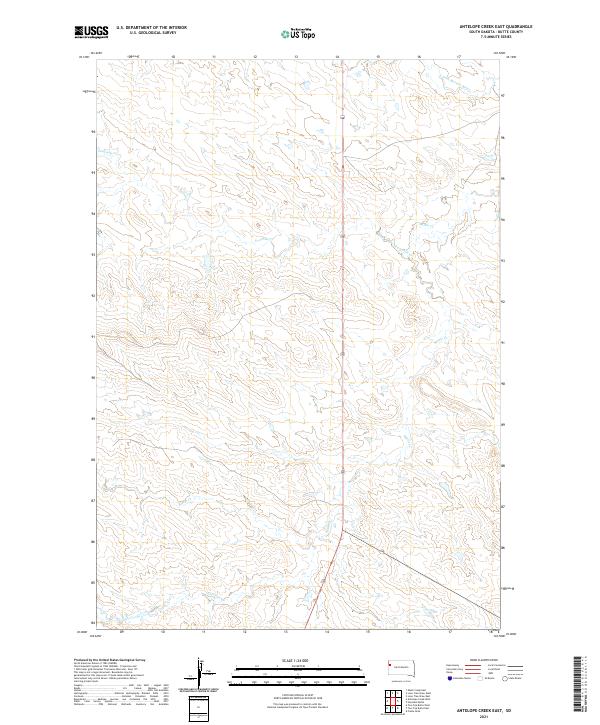
2021 Map of Antelope Creek East
USGS Topo · Published 2021About this map
S Fork Moreau River cuts across the northern reaches of this Butte County landscape, defining the drainage patterns for a series of seasonal creek systems. The terrain is structured by the prominent 85 and Hwy 168 corridors, which serve as the primary transit routes through these ranching and grazing lands. These roads follow the natural contours between the winding paths of Battle Creek and Fourmile Creek. The map provides a look at the precise township and range boundaries, including t13n r4e and t13n r5e, which organize the property lines and sections of the High Plains. While the area is sparse of permanent settlements, the intricate network of watercourses like Antelope Creek reflects the vital importance of water management in this western South Dakota environment.
Find a feature on this map
10 named features on this map. Tap any name to fly to it.
Don’t see what you’re looking for? This feature index may not catch every label — zoom into the map to look around manually.
Map Details
Editions of this 2021 Antelope Creek East Map
This is the sole edition of this map. No revisions or reprints were ever made.
Other maps of this area

1906 · Two Top
USGS Topo · 1:62,500

1907 · Belle Fourche
USGS Topo · 1:125,000

1913 · Newell
USGS Topo · 1:125,000

1935 · Hoover
USGS Topo · 1:125,000

1935 · Harding
USGS Topo · 1:125,000

1953 · Rapid City
USGS Topo · 1:250,000

1954 · Lemmon
USGS Topo · 1:250,000

1957 · Lemmon
USGS Topo · 1:250,000

1957 · Rapid City
USGS Topo · 1:250,000
1965 · Two Top Butte West
USGS Topo · 1:24,000