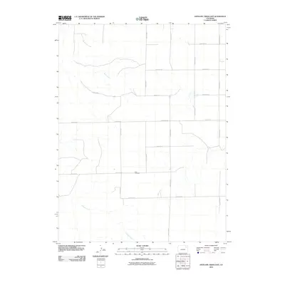
2010 Map of Antelope Creek East
USGS Topo · Published 2010About this map
Elba Cemetery serves as a central landmark in this portion of the eastern plains of Colorado, situated along a structured grid of rural transport routes. The landscape is defined by the intermittent drainage patterns of Antelope Creek, Buck Creek, and the aptly named Hell Creek. This 2010 survey illustrates the organized section lines and county road network, including County Rd 24 and County Road AA, which facilitate access across the open terrain. The mapping focuses on the intersection of these essential waterways and local roads, providing a precise look at the rural infrastructure and land management typical of the high plains during the early twenty-first century.
Find a feature on this map
16 named features on this map. Tap any name to fly to it.
Don’t see what you’re looking for? This feature index may not catch every label — zoom into the map to look around manually.
Map Details
Editions of this 2010 Antelope Creek East Map
This is the sole edition of this map. No revisions or reprints were ever made.
Other maps of this area

1954 · Limon
USGS Topo · 1:250,000

1954 · Sterling
USGS Topo · 1:250,000

1957 · Limon
USGS Topo · 1:250,000

1958 · Limon
USGS Topo · 1:250,000

1958 · Sterling
USGS Topo · 1:250,000

1973 · Antelope Creek East
USGS Topo · 1:24,000

1973 · Antelope Creek West
USGS Topo · 1:24,000

1973 · Dry Gulch
USGS Topo · 1:24,000

1973 · Rago
USGS Topo · 1:24,000

1973 · Antelope Creek SE
USGS Topo · 1:24,000