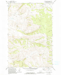
1971 Map of Antelope Creek
USGS Topo · Published 1991About this map
Deerlodge National Forest encompasses this high-elevation landscape within the John Long Mountains, where the 1971 U.S. Forest Service survey reveals a terrain defined by steep drainage networks and early mining activity. Small-scale resource extraction is evident from scattered Mines and a single Mine located north of Sluice Gulch, suggesting prospecting focused on the various forks of Antelope Creek and Upper Willow Creek. The presence of a Corral near the South Fork indicates seasonal livestock management in these remote gulches. The drainage patterns, including Wildcat Gulch and Sluice, reflect the heavy influence of hydraulic history and timber accessibility, while numerous 4WD tracks and a single Trail show how the region was navigated during the mid-20th century.
Find a feature on this map
22 named features on this map. Tap any name to fly to it.
Don’t see what you’re looking for? This feature index may not catch every label — zoom into the map to look around manually.
Map Details
Editions of this 1971 Antelope Creek Map
2 editions found
Other maps of this area

1908 · Philipsburg
USGS Topo · 1:125,000

1909 · Sapphire
USGS Topo · 1:125,000

1947 · Butte
USGS Topo · 1:250,000

1958 · Butte
USGS Topo · 1:250,000

1960 · Butte
USGS Topo · 1:250,000

1962 · Butte
USGS Topo · 1:250,000

1971 · Henderson Mountain
USGS Topo · 1:24,000

1971 · Georgetown Lake
USGS Topo · 1:24,000

1971 · Antelope Creek
USGS Topo · 1:24,000

1971 · Potato Lakes
USGS Topo · 1:24,000