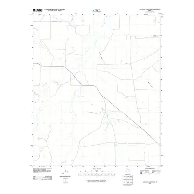
2010 Map of Antelope Creek SW
USGS Topo · Published 2010About this map
Millers Creek Reservoir defines the northern reaches of this rural Texas landscape, where several distinct drainages converge. The terrain is marked by a network of seasonal watercourses and local ranch roads, including Bow Creek and the meandering Squaw Creek. A notable engineering feature is the Big Wolf Tank Dam located near Wolf Creek in the northeastern corner. The map documents a sparse, agricultural infrastructure characterized by long-established routes such as Chamberlan Rd and Co Rd 190. These corridors connect the various creek valleys, from the narrow Spring Hollow to the broader flats of Wild Horse Creek, providing a detailed look at the hydrology and land-use patterns of Haskell County.
Find a feature on this map
19 named features on this map. Tap any name to fly to it.
Don’t see what you’re looking for? This feature index may not catch every label — zoom into the map to look around manually.
Map Details
Editions of this 2010 Antelope Creek SW Map
This is the sole edition of this map. No revisions or reprints were ever made.
Other maps of this area

1954 · Wichita Falls
USGS Topo · 1:250,000

1958 · Wichita Falls
USGS Topo · 1:250,000

1962 · Antelope Creek SW
USGS Topo · 1:24,000

1962 · Antelope Creek SE
USGS Topo · 1:24,000

1962 · Antelope Creek NE
USGS Topo · 1:24,000

1962 · Antelope Creek NW
USGS Topo · 1:24,000

1965 · Reynolds Bend NW
USGS Topo · 1:24,000

1966 · Tonk Creek
USGS Topo · 1:24,000
1966 · Irby
USGS Topo · 1:24,000

1967 · Mattson
USGS Topo · 1:24,000