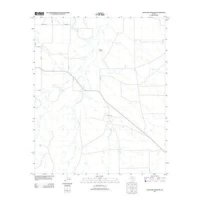
2013 Map of Antelope Creek SW
USGS Topo · Published 2013About this map
Spring Hollow sits at the heart of this North Texas landscape, where a dense network of seasonal drainages carves through the plains of Haskell County. The hydrology is dominated by numerous small watercourses including Millers Cr, Sulphur Cr, and Wild Horse Cr, which together define the local topography. This 2013 survey illustrates a sparsely populated ranching and agricultural region, where life is organized around the availability of water and a grid of rural county roads.
Find a feature on this map
20 named features on this map. Tap any name to fly to it.
Don’t see what you’re looking for? This feature index may not catch every label — zoom into the map to look around manually.
Map Details
Editions of this 2013 Antelope Creek SW Map
This is the sole edition of this map. No revisions or reprints were ever made.
Other maps of this area

1954 · Wichita Falls
USGS Topo · 1:250,000

1958 · Wichita Falls
USGS Topo · 1:250,000

1962 · Antelope Creek SW
USGS Topo · 1:24,000

1962 · Antelope Creek SE
USGS Topo · 1:24,000

1962 · Antelope Creek NE
USGS Topo · 1:24,000

1962 · Antelope Creek NW
USGS Topo · 1:24,000

1965 · Reynolds Bend NW
USGS Topo · 1:24,000

1966 · Tonk Creek
USGS Topo · 1:24,000
1966 · Irby
USGS Topo · 1:24,000

1967 · Mattson
USGS Topo · 1:24,000