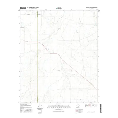
2016 Map of Antelope Creek SW
USGS Topo · Published 2016About this map
Millers Cr and its various tributaries carve a complex drainage system through the rolling ranchlands of North Texas. This 2016 survey highlights the sparse, pastoral nature of the region along the Haskell Co and Throckmorton Co line. Local family history is centered on landmarks like H C (Pick) Yandell and the settlement of Chamberlain in the northern portion of the quadrangle. The map details the local road network, including Ranch Rd 222 and FM 1720, which navigate the terrain alongside numerous named water features such as Wild Horse Cr, Gobbler Br, and Spring Hollow. This landscape is defined by its water management for livestock, evidenced by features like Big Wolf Tank near the eastern boundary.
Find a feature on this map
22 named features on this map. Tap any name to fly to it.
Don’t see what you’re looking for? This feature index may not catch every label — zoom into the map to look around manually.
Map Details
Editions of this 2016 Antelope Creek SW Map
This is the sole edition of this map. No revisions or reprints were ever made.
Other maps of this area

1954 · Wichita Falls
USGS Topo · 1:250,000

1958 · Wichita Falls
USGS Topo · 1:250,000

1962 · Antelope Creek SW
USGS Topo · 1:24,000

1962 · Antelope Creek SE
USGS Topo · 1:24,000

1962 · Antelope Creek NE
USGS Topo · 1:24,000

1962 · Antelope Creek NW
USGS Topo · 1:24,000

1965 · Reynolds Bend NW
USGS Topo · 1:24,000

1966 · Tonk Creek
USGS Topo · 1:24,000
1966 · Irby
USGS Topo · 1:24,000

1967 · Mattson
USGS Topo · 1:24,000