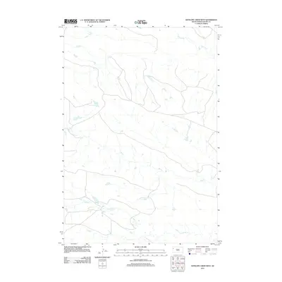
2012 Map of Antelope Creek West
USGS Topo · Published 2012About this map
Antelope Creek meanders through this portion of Butte County, defining the drainage patterns of a landscape characterized by its hydrological network. The area is defined by the convergence of several significant watercourses, including the central reaches of Battle Creek and the northern stretch of Fourmile Creek. These natural features suggest a terrain shaped by erosion and runoff, typical of the regional geography in South Dakota. While the map is sparse regarding named settlements, the intricate web of unnamed roads and trails shown intersecting these creeks indicates a land utilized for ranching or resource management. This 2012 survey by the U.S. Geological Survey provides a clear view of the rural infrastructure and physical landforms before further modern development altered the surface features.
Find a feature on this map
3 named features on this map. Tap any name to fly to it.
Don’t see what you’re looking for? This feature index may not catch every label — zoom into the map to look around manually.
Map Details
Editions of this 2012 Antelope Creek West Map
This is the sole edition of this map. No revisions or reprints were ever made.
Other maps of this area

1905 · Indian
USGS Topo · 1:62,500

1906 · Two Top
USGS Topo · 1:62,500

1907 · Belle Fourche
USGS Topo · 1:125,000

1935 · Harding
USGS Topo · 1:125,000

1953 · Rapid City
USGS Topo · 1:250,000

1954 · Lemmon
USGS Topo · 1:250,000

1957 · Lemmon
USGS Topo · 1:250,000

1957 · Rapid City
USGS Topo · 1:250,000
1965 · Antelope Butte
USGS Topo · 1:24,000
1965 · Two Top Butte West
USGS Topo · 1:24,000