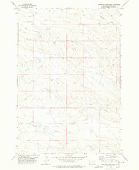
1977 Map of Antelope Creek West
USGS Topo · Published 1978About this map
Antelope Creek flows across the southern portion of this landscape in Butte County, defining a drainage pattern that characterizes this corner of the South Dakota plains. Photogrammetric methods from aerial photographs taken in 1973 reveal a sparsely populated expanse shaped by water and elevation, where the terrain is dominated by the intermittent flows of Battle Creek and Fourmile Creek. The map reflects a period in the late 1970s when the region's cattle-ranching heritage was represented by the wide-open spaces between these vital water sources. Surveyed by the U.S. Geological Survey and NOS/NOAA, the document serves as a precise record of the unimproved roads and fine-lined property boundaries that crisscrossed the grasslands during this era of Western land management.
Find a feature on this map
3 named features on this map. Tap any name to fly to it.
Don’t see what you’re looking for? This feature index may not catch every label — zoom into the map to look around manually.
Map Details
Editions of this 1977 Antelope Creek West Map
This is the sole edition of this map. No revisions or reprints were ever made.
Other maps of this area

1905 · Indian
USGS Topo · 1:62,500

1906 · Two Top
USGS Topo · 1:62,500

1907 · Belle Fourche
USGS Topo · 1:125,000

1935 · Harding
USGS Topo · 1:125,000

1953 · Rapid City
USGS Topo · 1:250,000

1954 · Lemmon
USGS Topo · 1:250,000

1957 · Lemmon
USGS Topo · 1:250,000

1957 · Rapid City
USGS Topo · 1:250,000
1965 · Antelope Butte
USGS Topo · 1:24,000
1965 · Two Top Butte West
USGS Topo · 1:24,000