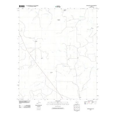
2010 Map of Antelope Gap
USGS Topo · Published 2010About this map
Pleasant Grove and Scallorn define the rural character of this Mills County landscape, where the terrain transitions from the high point of Bread Tray Mountain down through several prominent drainage basins. The area's hydrology is dominated by the systems of Simms Creek and its tributaries, including North Simms Creek and Bee Cove Creek, which carve through the local topography. At Antelope Gap, the land forms a natural passage that has long influenced the placement of travel routes like the Old Lometa Rd. In the northeastern portion of the quadrangle, Clift Lake and the Clift Lake Dam represent a localized water management feature amidst the network of county roads. The southern reaches are marked by Lee Gap and the meandering path of Antelope Creek, illustrating a classic Central Texas pattern of dispersed settlements connected by a grid of rural routes such as Farm Rd 2942.
Find a feature on this map
25 named features on this map. Tap any name to fly to it.
Don’t see what you’re looking for? This feature index may not catch every label — zoom into the map to look around manually.
Map Details
Editions of this 2010 Antelope Gap Map
This is the sole edition of this map. No revisions or reprints were ever made.
Other maps of this area

1885 · San Saba
USGS Topo · 1:125,000

1887 · Lampasas
USGS Topo · 1:125,000

1894 · Lampasas
USGS Topo · 1:125,000

1894 · San Saba
USGS Topo · 1:125,000

1925 · San Saba 4-a
USGS Topo · 1:48,000

1925 · San Saba 1-d
USGS Topo · 1:48,000

1928 · Goldthwaite
USGS Topo · 1:62,500

1931 · Bend
USGS Topo · 1:62,500

1948 · Goldthwaite
USGS Topo · 1:62,500
1950 · Goldthwaite
USGS Topo · 1:62,500