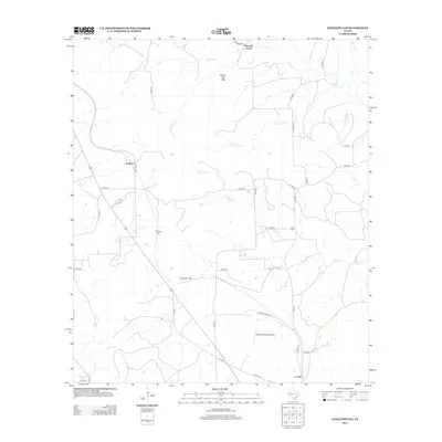
2012 Map of Antelope Gap
USGS Topo · Published 2012About this map
Bread Tray Mtn rises as a prominent landmark in this region of Mills County, where the Texas hill country transition is marked by numerous watercourses. The drainage network is dense with seasonal and perennial flows, including N Simms Cr, Bee Cove Cr, and Bear Cove Cr, which carve through the terrain near Long Cove. This 2012 survey illustrates a landscape of established rural settlements and ranching history, centering on locations like Pleasant Grove and Scallorn. Transportation routes such as FM-2942 and Scallorn Rd connect these remote communities, while the Birchfield Ranch Airport suggests the modern integration of aviation into the large-scale ranching operations of the area. Family and local history researchers can trace the roads leading to Antelope Gap and Lee Gap, defining the natural passes used by generations of residents.
Find a feature on this map
40 named features on this map. Tap any name to fly to it.
Don’t see what you’re looking for? This feature index may not catch every label — zoom into the map to look around manually.
Map Details
Editions of this 2012 Antelope Gap Map
This is the sole edition of this map. No revisions or reprints were ever made.
Other maps of this area

1885 · San Saba
USGS Topo · 1:125,000

1887 · Lampasas
USGS Topo · 1:125,000

1894 · Lampasas
USGS Topo · 1:125,000

1894 · San Saba
USGS Topo · 1:125,000

1925 · San Saba 4-a
USGS Topo · 1:48,000

1925 · San Saba 1-d
USGS Topo · 1:48,000

1928 · Goldthwaite
USGS Topo · 1:62,500

1931 · Bend
USGS Topo · 1:62,500

1948 · Goldthwaite
USGS Topo · 1:62,500
1950 · Goldthwaite
USGS Topo · 1:62,500