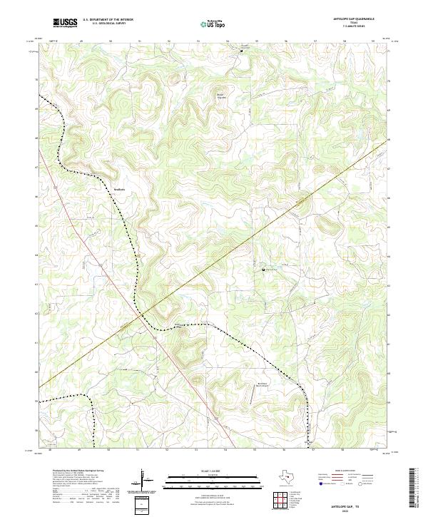
2022 Map of Antelope Gap
USGS Topo · Published 2022About this map
Scallorn sits at the intersection of rural transit routes in a landscape defined by the drainage basins of the Texas Hill Country. The terrain is dominated by significant relief, characterized by the prominent Bread Tray Mtn and the deep cuts of Bear Cove Cr and Bee Cove Cr. This 2022 survey captures a pastoral region where the transition between Mills Co and Lampasas Co follows the natural contours of the land rather than straight section lines. Rural infrastructure is concentrated around small-scale aviation and family history, with the Birchfield Ranch Airport serving the local ranching community. Cultural anchors are found in the remote corners of the quadrangle, including the Pleasant Grove Cem and Long Cove Cem, which provide essential touchpoints for genealogists researching the early settlement patterns of these central Texas counties.
Find a feature on this map
1 named feature on this map. Tap any name to fly to it.
Don’t see what you’re looking for? This feature index may not catch every label — zoom into the map to look around manually.
Map Details
Editions of this 2022 Antelope Gap Map
This is the sole edition of this map. No revisions or reprints were ever made.
Other maps of this area

1885 · San Saba
USGS Topo · 1:125,000

1887 · Lampasas
USGS Topo · 1:125,000

1894 · Lampasas
USGS Topo · 1:125,000

1894 · San Saba
USGS Topo · 1:125,000

1925 · San Saba 4-a
USGS Topo · 1:48,000

1925 · San Saba 1-d
USGS Topo · 1:48,000

1928 · Goldthwaite
USGS Topo · 1:62,500

1931 · Bend
USGS Topo · 1:62,500

1948 · Goldthwaite
USGS Topo · 1:62,500
1950 · Goldthwaite
USGS Topo · 1:62,500