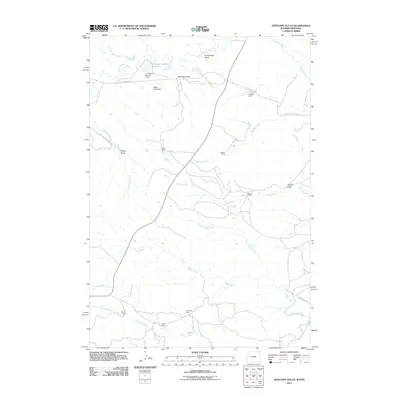
2011 Map of Antelope Gulch
USGS Topo · Published 2011About this map
The Little Missouri River and the Belle Fourche River define the drainage of this rangeland landscape along the Montana and Wyoming border. This 2011 survey documents a pastoral environment dominated by family-named ranching operations, including Ridinger Ranch, Foster Ranch, and Harney Ranch. The water management infrastructure essential for high-plains agriculture is visible through features like the T J Maupin Number 1 Dam and Banks Creek Dam, which create reservoirs such as the T J Maupin Number 1 Reservoir to support livestock. Evidence of mineral extraction is found in the south at the C Cockran Mine, situated near the Brushy Creek drainage. The map's detail provides a record of land use and property tenure, tracing the legacy of homesteads such as the Edsall Ranch and the Cochrun Ranch across a network of rural routes like Little Missouri Rd and Stoneville Rd.
Find a feature on this map
26 named features on this map. Tap any name to fly to it.
Don’t see what you’re looking for? This feature index may not catch every label — zoom into the map to look around manually.
Map Details
Editions of this 2011 Antelope Gulch Map
This is the sole edition of this map. No revisions or reprints were ever made.
Other maps of this area

1901 · Aladdin
USGS Topo · 1:125,000

1903 · Aladdin
USGS Topo · 1:125,000

1905 · Devils Tower
USGS Topo · 1:125,000

1954 · Ekalaka
USGS Topo · 1:250,000

1954 · Gillette
USGS Topo · 1:250,000

1955 · Gillette
USGS Topo · 1:250,000

1956 · Ekalaka
USGS Topo · 1:250,000

1957 · Mona
USGS Topo · 1:62,500

1957 · Seely
USGS Topo · 1:62,500

1958 · Gillette
USGS Topo · 1:250,000