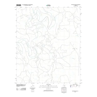
2010 Map of Antelope Hills
USGS Topo · Published 2010About this map
The Clear Fork-Brazos River meanders extensively through this Haskell County landscape, creating a complex series of oxbows and bends that define the local geography. This 2010 survey illustrates a primarily rural environment where water management and topography are the primary features of the land. The eastern portion of the quadrangle is dominated by the Antelope Hills, a prominent terrain feature that rises above the surrounding drainage basins. Several watercourses, including Antelope Creek, Fish Creek, and Wolf Creek, feed into the river system, carving shallow valleys through the countryside. Human infrastructure is represented by a sparse network of local roads such as Cook Field Rd and Pvt Rd 2271, which navigate the elevation changes between the river basin and the higher ground of the hills.
Find a feature on this map
7 named features on this map. Tap any name to fly to it.
Don’t see what you’re looking for? This feature index may not catch every label — zoom into the map to look around manually.
Map Details
Editions of this 2010 Antelope Hills Map
This is the sole edition of this map. No revisions or reprints were ever made.
Other maps of this area

1891 · Anson
USGS Topo · 1:125,000

1892 · Albany
USGS Topo · 1:125,000

1893 · Albany
USGS Topo · 1:125,000

1893 · Anson
USGS Topo · 1:125,000

1954 · Abilene
USGS Topo · 1:250,000

1954 · Wichita Falls
USGS Topo · 1:250,000

1958 · Wichita Falls
USGS Topo · 1:250,000

1958 · Abilene
USGS Topo · 1:250,000

1965 · Lueders NE
USGS Topo · 1:24,000

1965 · Collins Creek
USGS Topo · 1:24,000