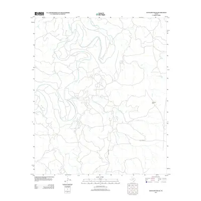
2012 Map of Antelope Hills
USGS Topo · Published 2012About this map
Clear Fork meanders through the heart of this Haskell County landscape, defining the local drainage patterns as it flows toward the eastern edges of the quadrangle. The terrain is characterized by the prominent elevation of the Antelope Hills, which rise above a network of seasonal watercourses including Antelope Cr and Fish Cr. This 2012 survey illustrates the modern layout of rural access in north-central Texas, where roads like Nail Ranch Rd and Cook Field Rd provide the primary infrastructure through large ranching tracts. The map reveals a sparsely populated area where the natural topography and waterway systems dictate the placement of land boundaries and local transport routes.
Find a feature on this map
6 named features on this map. Tap any name to fly to it.
Don’t see what you’re looking for? This feature index may not catch every label — zoom into the map to look around manually.
Map Details
Editions of this 2012 Antelope Hills Map
This is the sole edition of this map. No revisions or reprints were ever made.
Other maps of this area

1891 · Anson
USGS Topo · 1:125,000

1892 · Albany
USGS Topo · 1:125,000

1893 · Albany
USGS Topo · 1:125,000

1893 · Anson
USGS Topo · 1:125,000

1954 · Abilene
USGS Topo · 1:250,000

1954 · Wichita Falls
USGS Topo · 1:250,000

1958 · Wichita Falls
USGS Topo · 1:250,000

1958 · Abilene
USGS Topo · 1:250,000

1965 · Lueders NE
USGS Topo · 1:24,000

1965 · Collins Creek
USGS Topo · 1:24,000