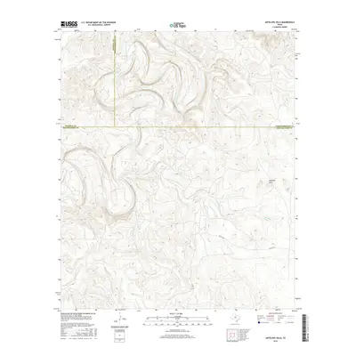
2016 Map of Antelope Hills
USGS Topo · Published 2016About this map
The Antelope Hills rise as a prominent topographic feature where the borders of Haskell, Throckmorton, and Shackelford counties converge. This landscape is defined by the winding course of the Clear Fork of the Brazos River, which meanders through the northwestern portion of the map. Several tributaries, including Antelope Cr, Wolf Cr, and Fish Cr, carve deep drainage patterns into the surrounding terrain, illustrating the hydrologic character of this part of North Texas.
Find a feature on this map
10 named features on this map. Tap any name to fly to it.
Don’t see what you’re looking for? This feature index may not catch every label — zoom into the map to look around manually.
Map Details
Editions of this 2016 Antelope Hills Map
This is the sole edition of this map. No revisions or reprints were ever made.
Other maps of this area

1891 · Anson
USGS Topo · 1:125,000

1892 · Albany
USGS Topo · 1:125,000

1893 · Albany
USGS Topo · 1:125,000

1893 · Anson
USGS Topo · 1:125,000

1954 · Abilene
USGS Topo · 1:250,000

1954 · Wichita Falls
USGS Topo · 1:250,000

1958 · Wichita Falls
USGS Topo · 1:250,000

1958 · Abilene
USGS Topo · 1:250,000

1965 · Lueders NE
USGS Topo · 1:24,000

1965 · Collins Creek
USGS Topo · 1:24,000