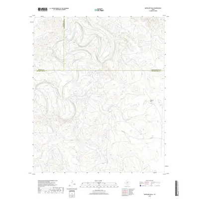
2019 Map of Antelope Hills
USGS Topo · Published 2019About this map
The Clear-Fork-Brazos-River winds through a complex series of bends in this rural landscape where Haskell, Throckmorton, and Shackelford counties converge. The terrain is defined by the prominent Antelope Hills and the dissected drainages of Antelope Cr, Wolf Cr, and Fish Cr. This area of North Texas remains largely undeveloped, characterized by wide-open ranch land and private corridors like Pvt Rd 2271 and Co Rd 157. The map illustrates a section of the Brazos River system before it flows further east, showing the natural topography and primitive road networks that have shaped land use in this part of the state for generations.
Find a feature on this map
10 named features on this map. Tap any name to fly to it.
Don’t see what you’re looking for? This feature index may not catch every label — zoom into the map to look around manually.
Map Details
Editions of this 2019 Antelope Hills Map
This is the sole edition of this map. No revisions or reprints were ever made.
Other maps of this area

1891 · Anson
USGS Topo · 1:125,000

1892 · Albany
USGS Topo · 1:125,000

1893 · Albany
USGS Topo · 1:125,000

1893 · Anson
USGS Topo · 1:125,000

1954 · Abilene
USGS Topo · 1:250,000

1954 · Wichita Falls
USGS Topo · 1:250,000

1958 · Wichita Falls
USGS Topo · 1:250,000

1958 · Abilene
USGS Topo · 1:250,000

1965 · Lueders NE
USGS Topo · 1:24,000

1965 · Collins Creek
USGS Topo · 1:24,000