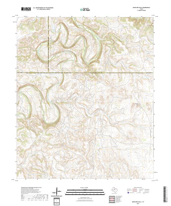
2022 Map of Antelope Hills
USGS Topo · Published 2022About this map
The Clear Fork Brazos River winds through this North Texas landscape, defining the boundaries where Haskell, Throckmorton, and Shackelford counties converge. The terrain is characterized by the prominent Antelope Hills in the southeast, which rise above the surrounding drainage basins. This modern survey illustrates a sparsely populated region where water is the primary geographic driver, shown through the intricate paths of Wolf Cr, Antelope Cr, and Fish Cr. The land remains largely rural, connected by local routes like Co RD 157 and PVT RD 2271, reflecting a cattle-ranching and oil-producing heritage where the natural topography dictates the few established paths across the rolling breaks of the Brazos River system.
Find a feature on this map
10 named features on this map. Tap any name to fly to it.
Don’t see what you’re looking for? This feature index may not catch every label — zoom into the map to look around manually.
Map Details
Editions of this 2022 Antelope Hills Map
This is the sole edition of this map. No revisions or reprints were ever made.
Other maps of this area

1891 · Anson
USGS Topo · 1:125,000

1892 · Albany
USGS Topo · 1:125,000

1893 · Albany
USGS Topo · 1:125,000

1893 · Anson
USGS Topo · 1:125,000

1954 · Abilene
USGS Topo · 1:250,000

1954 · Wichita Falls
USGS Topo · 1:250,000

1958 · Wichita Falls
USGS Topo · 1:250,000

1958 · Abilene
USGS Topo · 1:250,000

1965 · Lueders NE
USGS Topo · 1:24,000

1965 · Collins Creek
USGS Topo · 1:24,000