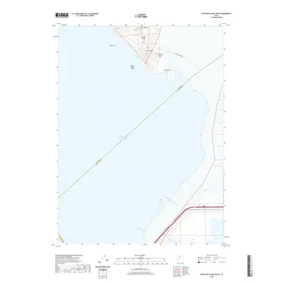
2020 Map of Antelope Island South
USGS Topo · Published 2020About this map
Antelope Island rises from the southeastern reaches of the Great Salt Lake, revealing a landscape of prominent ridges and named coastal features. The northern portion of the sheet is dominated by the island's southern interior, where elevations like Mollys Nipple, Garr Knolls, and the elongated Daddy Stump Ridge define the local topography. This area highlights the transition between the island’s solid ground and the fluctuating water levels of the surrounding brine, evidenced by the presence of Miera Spit and the Antelope Island Bar. Along the eastern shoreline, Unicorn Point juts into the lake, while Indian Bay and McInture Spring offer distinct hydrological markers. To the south, the map captures the industrial and transit corridor where W North Temple St and Interstate 80 cross the salt flats near the mouth of Lee Cr, marking the boundary between Davis and Salt Lake counties.
Find a feature on this map
16 named features on this map. Tap any name to fly to it.
Don’t see what you’re looking for? This feature index may not catch every label — zoom into the map to look around manually.
Map Details
Editions of this 2020 Antelope Island South Map
This is the sole edition of this map. No revisions or reprints were ever made.
Other maps of this area

1885 · Tooele Valley
USGS Topo · 1:250,000

1951 · Saltair
USGS Topo · 1:24,000

1952 · Saltair NE
USGS Topo · 1:24,000

1952 · Magna
USGS Topo · 1:24,000

1952 · Antelope Island South
USGS Topo · 1:24,000

1952 · Garfield
USGS Topo · 1:24,000

1953 · Tooele
USGS Topo · 1:250,000

1954 · Antelope Island
USGS Topo · 1:24,000

1955 · Mills Junction
USGS Topo · 1:24,000

1955 · Tooele
USGS Topo · 1:250,000