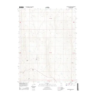
2014 Map of Antelope Mountain
USGS Topo · Published 2014About this map
Antelope Mountain and the high desert terrain of the White Pine Range dominate this 2014 topographic study of Nevada's interior. The map illustrates a landscape shaped by significant elevation changes, ranging from the volcanic forms of Buster Mtn to the high pass at Little Antelope Summit. Water sources are critical identifiers in this arid environment, with several specific springs such as Antelope Spring, Little Antelope Spring, and Divide Spring marked across the terrain. These features, along with Halstead Cr, delineate the sparse but vital drainage patterns of the region. To the east, the rising slopes of the Butte Mountains frame the high-altitude topography, providing a detailed look at the geographic character of this portion of White Pine County.
Find a feature on this map
10 named features on this map. Tap any name to fly to it.
Don’t see what you’re looking for? This feature index may not catch every label — zoom into the map to look around manually.
Map Details
Editions of this 2014 Antelope Mountain Map
This is the sole edition of this map. No revisions or reprints were ever made.
Other maps of this area

1951 · Illipah
USGS Topo · 1:62,500

1951 · Pancake Summit
USGS Topo · 1:62,500

1956 · Ely
USGS Topo · 1:250,000

1957 · Buck Mountain
USGS Topo · 1:62,500

1959 · Ely
USGS Topo · 1:250,000

1963 · Ely
USGS Topo · 1:250,000

1979 · Mt. Hamilton
USGS Topo · 1:100,000

1982 · Dickenson Well
USGS Topo · 1:24,000

1982 · Sunshine Well
USGS Topo · 1:24,000

1985 · Newark Lake
USGS Topo · 1:100,000