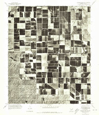
1971 Map of Antelope Peak NE
USGS Topo · Published 1972About this map
Vekol Wash cuts across the northwest corner of this Pinal County landscape, providing a stark contrast to the highly developed agricultural grid that dominates the region. This orthophotoquad, created from aerial photography taken in the summer of 1971, reveals the intense land use patterns of Arizona's high desert during a period of significant irrigation expansion. The visual data captured here illustrates the geometric precision of the irrigation blocks and field boundaries, showing how water management transformed the desert floor. Unlike a traditional topographic map, the photographic detail of this survey allows for the direct observation of field textures, access roads, and the natural drainage patterns of the wash as they appeared in the early 1970s.
Find a feature on this map
1 named feature on this map. Tap any name to fly to it.
Don’t see what you’re looking for? This feature index may not catch every label — zoom into the map to look around manually.
Map Details
Editions of this 1971 Antelope Peak NE Map
This is the sole edition of this map. No revisions or reprints were ever made.
Other maps of this area

1913 · Maricopa
USGS Topo · 1:62,500

1914 · Gila Butte
USGS Topo · 1:62,500

1915 · Maricopa
USGS Topo · 1:62,500

1917 · Gila Butte
USGS Topo · 1:62,500

1922 · Casa Grande
USGS Topo · 1:62,500

1924 · Casa Grande
USGS Topo · 1:62,500

1946 · Antelope Peak
USGS Topo · 1:62,500

1948 · Antelope Peak
USGS Topo · 1:62,500

1952 · Maricopa
USGS Topo · 1:24,000

1952 · Sacaton Butte
USGS Topo · 1:24,000