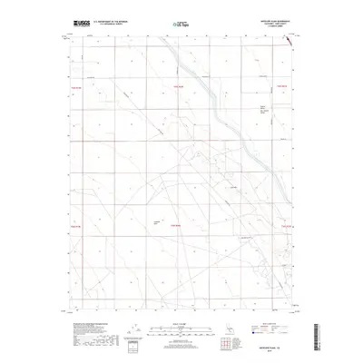
2018 Map of Antelope Plain
USGS Topo · Published 2018About this map
The Governor-Edmund-G-Brown-California-Aqueduct cuts a distinct path through the western edge of the San Joaquin Valley, defining the modern water infrastructure of this agricultural corridor. Set within the Antelope Plain, the landscape is dominated by a grid of section lines and access roads such as Twisselman Rd and Holloway Rd, which serve the region's industrial and farming operations.
Find a feature on this map
19 named features on this map. Tap any name to fly to it.
Don’t see what you’re looking for? This feature index may not catch every label — zoom into the map to look around manually.
Map Details
Editions of this 2018 Antelope Plain Map
This is the sole edition of this map. No revisions or reprints were ever made.
Other maps of this area

1914 · Lost Hills
USGS Topo · 1:125,000

1930 · Avenal Gap
USGS Topo · 1:31,680

1932 · Antelope Plain
USGS Topo · 1:31,680

1932 · West of Goose Lake
USGS Topo · 1:31,680

1932 · Reynolds Ranch
USGS Topo · 1:31,680

1932 · West Camp
USGS Topo · 1:31,680

1932 · Lone Tree Well
USGS Topo · 1:31,680

1933 · Avenal Gap
USGS Topo · 1:31,680

1934 · West of Goose Lake
USGS Topo · 1:31,680
1935 · West Camp
USGS Topo · 1:31,680