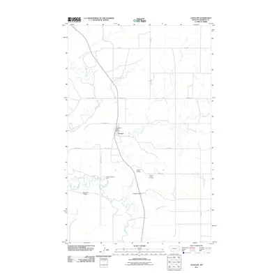
2011 Map of Antelope
USGS Topo · Published 2011About this map
Antelope serves as the primary settlement on this Sheridan County landscape, where the Antelope Post Office anchors a rural network of roads and drainage basins. The area is defined by the winding course of Big Muddy Creek, which is joined by tributaries including Ator Creek and Antelope Creek. A distinct hydraulic landscape is visible at the Freske Number 1 Dam, reflecting local water management efforts in this northern prairie environment.
Find a feature on this map
21 named features on this map. Tap any name to fly to it.
Don’t see what you’re looking for? This feature index may not catch every label — zoom into the map to look around manually.
Map Details
Editions of this 2011 Antelope Map
This is the sole edition of this map. No revisions or reprints were ever made.
Other maps of this area

1948 · Reserve SE
USGS Topo · 1:24,000

1948 · Reserve
USGS Topo · 1:24,000

1948 · Alkali Coulee
USGS Topo · 1:24,000

1948 · Antelope
USGS Topo · 1:24,000

1949 · Reserve SE
USGS Topo · 1:24,000

1949 · Reserve
USGS Topo · 1:24,000

1949 · Antelope
USGS Topo · 1:24,000

1949 · Alkali Coulee
USGS Topo · 1:24,000

1950 · Shippe Canyon
USGS Topo · 1:24,000

1954 · Wolf Point
USGS Topo · 1:250,000