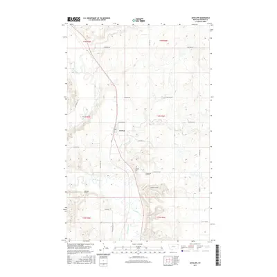
2017 Map of Antelope
USGS Topo · Published 2017About this map
Antelope serves as a central hub in this corner of Sheridan County, where the plains are etched by the meandering course of Big Muddy Creek. This landscape is defined by the practicalities of rural Montana life, with a network of section-line roads like Whitish Hill Rd and Coalridge Hwy connecting scattered homesteads and ranches. Local heritage is anchored by the presence of both the Antelope Catholic Cem and the Antelope Creek Cem, which sit south of the town center near the confluence of Antelope Cr and the larger creek basin. The terrain transitions into deeper drainage patterns at Clarence Coulee and Folsom Coulee, showing the natural erosion of the prairie floor. This 2017 survey reflects a modern view of a community that remains tied to its geography and agricultural roots.
Find a feature on this map
28 named features on this map. Tap any name to fly to it.
Don’t see what you’re looking for? This feature index may not catch every label — zoom into the map to look around manually.
Map Details
Editions of this 2017 Antelope Map
This is the sole edition of this map. No revisions or reprints were ever made.
Other maps of this area

1948 · Reserve SE
USGS Topo · 1:24,000

1948 · Reserve
USGS Topo · 1:24,000

1948 · Alkali Coulee
USGS Topo · 1:24,000

1948 · Antelope
USGS Topo · 1:24,000

1949 · Reserve SE
USGS Topo · 1:24,000

1949 · Reserve
USGS Topo · 1:24,000

1949 · Antelope
USGS Topo · 1:24,000

1949 · Alkali Coulee
USGS Topo · 1:24,000

1950 · Shippe Canyon
USGS Topo · 1:24,000

1954 · Wolf Point
USGS Topo · 1:250,000