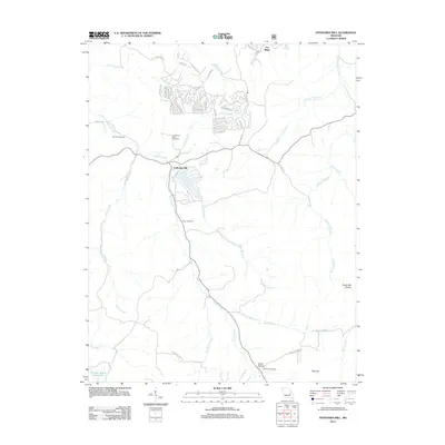
2012 Map of Anthonies Mill
USGS Topo · Published 2012About this map
Anthonies Mill serves as the focal point of this Ozark landscape, where the confluence of Brazil Creek and Harris Branch defines the local topography. This 2012 survey reveals a complex of residential development north of the mill site, characterized by winding roads like Burr Oak DR and Lake Shore DR surrounding a small reservoir. The area is notable for its numerous family and community burial grounds, including Record Cemetery, Anthonie's Mill Cemetery, Swan Cemetery, and Metcalf Cemetery, providing essential landmarks for genealogical research in Washington County.
Find a feature on this map
51 named features on this map. Tap any name to fly to it.
Don’t see what you’re looking for? This feature index may not catch every label — zoom into the map to look around manually.
Map Details
Editions of this 2012 Anthonies Mill Map
This is the sole edition of this map. No revisions or reprints were ever made.
Other maps of this area

1901 · De Soto
USGS Topo · 1:125,000

1903 · Sullivan
USGS Topo · 1:125,000

1906 · Potosi
USGS Topo · 1:62,500

1934 · Meramec State Park
USGS Topo · 1:24,000

1937 · Meramec State Park
USGS Topo · 1:24,000

1943 · Berryman
USGS Topo · 1:62,500

1945 · Berryman
USGS Topo · 1:62,500

1946 · Richwoods
USGS Topo · 1:62,500

1947 · Sullivan
USGS Topo · 1:62,500

1948 · Richwoods
USGS Topo · 1:62,500