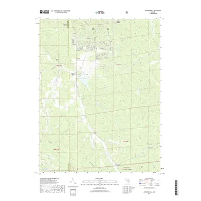
2017 Map of Anthonies Mill
USGS Topo · Published 2017About this map
Anthonies Mill sits near the crossing of Harris Br and Brazil Cr, serving as a central point of settlement in this part of Washington County. The landscape is defined by the winding drainages of Little Courtois Cr and Sugarcreek, which carve through the Ozark terrain toward the Mark Twain National Forest boundary. Family and community heritage is evident in the multiple burial grounds scattered throughout the hills, including Anthonie's Mill Cem, Swan Cem, and the Metcalf Cem located near Greer Hollow. Residential developments like those near Pea Ridge and Kentucky Bend illustrate the modern interface between rural Missouri life and the protected woodlands of the forest service lands, where narrow roads like Chisholm Trl and Quail Run Dr provide access to the ridge tops and creek bottoms.
Find a feature on this map
71 named features on this map. Tap any name to fly to it.
Don’t see what you’re looking for? This feature index may not catch every label — zoom into the map to look around manually.
Map Details
Editions of this 2017 Anthonies Mill Map
This is the sole edition of this map. No revisions or reprints were ever made.
Other maps of this area

1901 · De Soto
USGS Topo · 1:125,000

1903 · Sullivan
USGS Topo · 1:125,000

1906 · Potosi
USGS Topo · 1:62,500

1934 · Meramec State Park
USGS Topo · 1:24,000

1937 · Meramec State Park
USGS Topo · 1:24,000

1943 · Berryman
USGS Topo · 1:62,500

1945 · Berryman
USGS Topo · 1:62,500

1946 · Richwoods
USGS Topo · 1:62,500

1947 · Sullivan
USGS Topo · 1:62,500

1948 · Richwoods
USGS Topo · 1:62,500