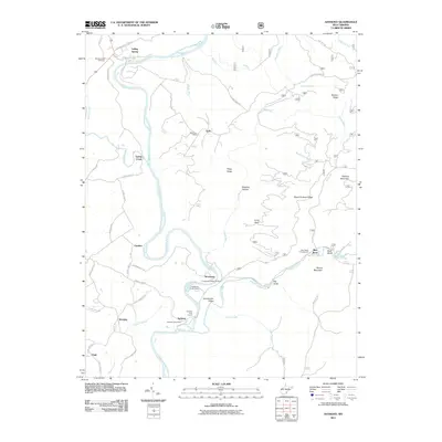
2011 Map of Anthony
USGS Topo · Published 2011About this map
The Greenbrier River carves a deep path through Greenbrier County, serving as the primary geographical focus for the settlements of Falling Spring, Spring Creek, and Anthony. This landscape is defined by its rugged ridges and intricate drainage systems, where Anthony Creek joins the river near the Blue Bend Campground. Local history is anchored by sites such as the Morning Side Cemetery and the rural post offices at Auto Post Office and Anthony Post Office, which once served these small mountain communities. Higher elevations like Hopkins Mountain and Round Mountain look down upon the river valley, while the presence of the Old Civil War Trl near Auto suggests long-standing transit corridors through the wooded hills. For outdoor enthusiasts and historians, the map identifies public sites like the Greenbrier Youth Camp and the Anthony Boat Launch, documenting the region's recreational character.
Find a feature on this map
55 named features on this map. Tap any name to fly to it.
Don’t see what you’re looking for? This feature index may not catch every label — zoom into the map to look around manually.
Map Details
Editions of this 2011 Anthony Map
This is the sole edition of this map. No revisions or reprints were ever made.
Other maps of this area

1887 · Lewisburg
USGS Topo · 1:125,000

1891 · Lewisburg
USGS Topo · 1:125,000

1891 · Huntersville
USGS Topo · 1:125,000

1894 · Huntersville
USGS Topo · 1:125,000

1921 · Callaghan
USGS Topo · 1:48,000

1921 · White Sulphur Springs
USGS Topo · 1:48,000

1923 · Lobelia
USGS Topo · 1:48,000

1923 · White Sulphur Springs
USGS Topo · 1:62,500

1923 · Marlinton
USGS Topo · 1:48,000

1923 · Callaghan
USGS Topo · 1:62,500