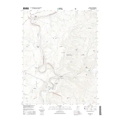
2014 Map of Anthony
USGS Topo · Published 2014About this map
The Greenbrier River serves as the central artery of this landscape, its path winding through the Monongahela National Forest and past several small valley settlements. The river's historical importance for transit is evident at the Renick Bridge and the conversion of old paths into the modern Greenbrier River Trl. Rural life is centered around community clusters like Falling Spring, Spring Creek, and Anthony, with local heritage preserved at Morning Side Cem and Walnut Grove Cem. The map reveals a transition from valley bottoms to the steep ridgelines of Panther Ridge and Greenbrier Mtn. High points such as Gunpowder Ridge Overlook offer vantage points over the heavily dissected terrain, while more recent development is noted in the Anthony Woods Subd near the river's edge.
Find a feature on this map
62 named features on this map. Tap any name to fly to it.
Don’t see what you’re looking for? This feature index may not catch every label — zoom into the map to look around manually.
Map Details
Editions of this 2014 Anthony Map
This is the sole edition of this map. No revisions or reprints were ever made.
Other maps of this area

1887 · Lewisburg
USGS Topo · 1:125,000

1891 · Lewisburg
USGS Topo · 1:125,000

1891 · Huntersville
USGS Topo · 1:125,000

1894 · Huntersville
USGS Topo · 1:125,000

1921 · Callaghan
USGS Topo · 1:48,000

1921 · White Sulphur Springs
USGS Topo · 1:48,000

1923 · Lobelia
USGS Topo · 1:48,000

1923 · White Sulphur Springs
USGS Topo · 1:62,500

1923 · Marlinton
USGS Topo · 1:48,000

1923 · Callaghan
USGS Topo · 1:62,500