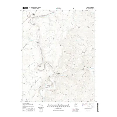
2016 Map of Anthony
USGS Topo · Published 2016About this map
The Greenbrier River carves a deep path through Greenbrier County, anchoring a landscape where river-level transport and high-ridge forestry meet. The Greenbrier River Rail-Trail follows the river's winding eastern bank, tracing the legacy of the old rail corridor through small settlements like Gardner and Woodman. In the northern section, Falling Spring and Spring Creek serve as local hubs near the Renick Bridge, with the Morning Side Cem and Walnut Grove Cem providing essential points of interest for genealogists tracking families in this river valley.
Find a feature on this map
75 named features on this map. Tap any name to fly to it.
Don’t see what you’re looking for? This feature index may not catch every label — zoom into the map to look around manually.
Map Details
Editions of this 2016 Anthony Map
This is the sole edition of this map. No revisions or reprints were ever made.
Other maps of this area

1887 · Lewisburg
USGS Topo · 1:125,000

1891 · Lewisburg
USGS Topo · 1:125,000

1891 · Huntersville
USGS Topo · 1:125,000

1894 · Huntersville
USGS Topo · 1:125,000

1921 · Callaghan
USGS Topo · 1:48,000

1921 · White Sulphur Springs
USGS Topo · 1:48,000

1923 · Lobelia
USGS Topo · 1:48,000

1923 · White Sulphur Springs
USGS Topo · 1:62,500

1923 · Marlinton
USGS Topo · 1:48,000

1923 · Callaghan
USGS Topo · 1:62,500