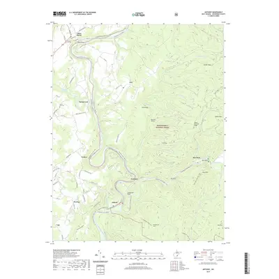
2019 Map of Anthony
USGS Topo · Published 2019About this map
The Greenbrier River Rail-Trail follows the winding path of the Greenbrier River as it cuts through the mountains of Greenbrier County. This landscape is defined by the sharp contrast between the narrow, inhabited river valleys and the expansive heights of the Monongahela National Forest. Small settlements like Falling Spring, Anthony, and Spring Creek are positioned along the river's bends, connected by historic crossings such as the Renick Bridge.
Find a feature on this map
78 named features on this map. Tap any name to fly to it.
Don’t see what you’re looking for? This feature index may not catch every label — zoom into the map to look around manually.
Map Details
Editions of this 2019 Anthony Map
This is the sole edition of this map. No revisions or reprints were ever made.
Other maps of this area

1887 · Lewisburg
USGS Topo · 1:125,000

1891 · Lewisburg
USGS Topo · 1:125,000

1891 · Huntersville
USGS Topo · 1:125,000

1894 · Huntersville
USGS Topo · 1:125,000

1921 · Callaghan
USGS Topo · 1:48,000

1921 · White Sulphur Springs
USGS Topo · 1:48,000

1923 · Lobelia
USGS Topo · 1:48,000

1923 · White Sulphur Springs
USGS Topo · 1:62,500

1923 · Marlinton
USGS Topo · 1:48,000

1923 · Callaghan
USGS Topo · 1:62,500