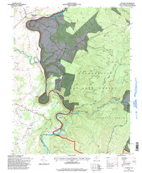
1995 Map of Anthony
USGS Topo · Published 1998About this map
The Greenbrier River carves a deep valley through this portion of Greenbrier County, shaping a landscape defined by sharp ridges and riverside settlements. In the northern reaches, Falling Spring (Renick PO) serves as a primary hub, while the Greenbrier River Trail follows the western bank southward past Gardner and Woodman. The terrain is characterized by dramatic elevation changes, notably at Falling Spring Ridge and Panther Ridge, which rise steeply from the riverbed.
Find a feature on this map
49 named features on this map. Tap any name to fly to it.
Don’t see what you’re looking for? This feature index may not catch every label — zoom into the map to look around manually.
Map Details
Editions of this 1995 Anthony Map
This is the sole edition of this map. No revisions or reprints were ever made.
Other maps of this area

1887 · Lewisburg
USGS Topo · 1:125,000

1891 · Lewisburg
USGS Topo · 1:125,000

1891 · Huntersville
USGS Topo · 1:125,000

1894 · Huntersville
USGS Topo · 1:125,000

1921 · Callaghan
USGS Topo · 1:48,000

1921 · White Sulphur Springs
USGS Topo · 1:48,000

1923 · Lobelia
USGS Topo · 1:48,000

1923 · White Sulphur Springs
USGS Topo · 1:62,500

1923 · Marlinton
USGS Topo · 1:48,000

1923 · Callaghan
USGS Topo · 1:62,500