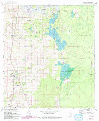
1967 Map of Anthony
USGS Topo · Published 1993About this map
Anthony and the surrounding Marion County landscape are captured during a period of transition, showing a mosaic of wetlands and small rural settlements. The central corridor is dominated by the vast, marshy expanse of Goose Prairie and Indian Lake Prairie, which dictate the local road patterns and land use. To the west, the community of Sparr sits near the St Josephs Ch, while the southern reaches feature the Oak-Griner Sch near the settlement of Oak. Local history and genealogy interest is concentrated in several rural congregational sites, including New Hope Ch and the Mt Olive Cem found near the Mt Olive Ch. An interesting aeronautical detail is the Landing Strip located north of Oak Road, serving this agricultural and ranching district.
Find a feature on this map
29 named features on this map. Tap any name to fly to it.
Don’t see what you’re looking for? This feature index may not catch every label — zoom into the map to look around manually.
Map Details
Editions of this 1967 Anthony Map
3 editions found
Other maps of this area

1893 · Citra
USGS Topo · 1:62,500

1895 · Citra
USGS Topo · 1:62,500

1895 · Ocala
USGS Topo · 1:62,500

1954 · Gainesville
USGS Topo · 1:250,000

1954 · Daytona Beach
USGS Topo · 1:250,000

1958 · Daytona Beach
USGS Topo · 1:250,000

1958 · Gainesville
USGS Topo · 1:250,000

1959 · Gainesville
USGS Topo · 1:250,000

1964 · Daytona Beach
USGS Topo · 1:250,000
1967 · Citra
USGS Topo · 1:24,000