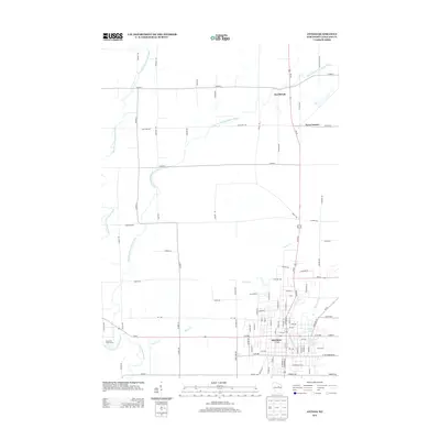
2013 Map of Antigo
USGS Topo · Published 2013About this map
The city of Antigo serves as the primary hub on this Langlade County landscape, situated where the Spring Brook and Oldens Cr drainage systems meet. The urban grid is clearly defined, with industrial and residential sectors concentrated near Antigo Lake. Beyond the city limits, the terrain transitions into a structured rural network defined by the West Branch Eau Claire River and its eastern counterpart. Small settlements such as Deerbrook and Neva Corners mark key intersections along Us-45, highlighting the area's historical reliance on these transit corridors. The map details a mix of developed land, such as the Riverview Golf Course, and the more open agricultural reaches of the north, where roads like Co Hwy-C and Blue Bell Rd cross the branching river systems.
Find a feature on this map
96 named features on this map. Tap any name to fly to it.
Don’t see what you’re looking for? This feature index may not catch every label — zoom into the map to look around manually.
Map Details
Editions of this 2013 Antigo Map
This is the sole edition of this map. No revisions or reprints were ever made.
Other maps of this area

1899 · Wausau
USGS Topo · 1:125,000

1902 · Wausau
USGS Topo · 1:125,000

1940 · Parrish
USGS Topo · 1:48,000

1942 · Elcho
USGS Topo · 1:48,000

1950 · Elcho
USGS Topo · 1:48,000

1950 · Parrish
USGS Topo · 1:48,000

1951 · Doering
USGS Topo · 1:48,000

1952 · Parrish
USGS Topo · 1:48,000

1952 · Antigo
USGS Topo · 1:48,000

1954 · Iron Mountain
USGS Topo · 1:250,000