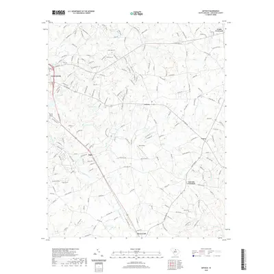
2020 Map of Antioch
USGS Topo · Published 2020About this map
Lancaster anchors the western edge of this landscape, where the town's edge transitions into the rolling creek drainages of Lancaster County. Central to the map is Kirk Air Base, situated amidst a network of rural settlements including Antioch, Elgin, and Primus. The terrain is defined by its many watercourses, with Turkey Quarter Creek and Gills Creek carving through the countryside. These waterways are punctuated by local landmarks like Betheas Pond and Burnetts Pond. Local history and genealogy are preserved in sites such as Caskey Cemetery and Baskins Cemetery, which sit alongside historic intersections like Rich Hill Crossroads and Dwight Crossroads. The map reveals a community structured by family-named roads and rural infrastructure, from Pleasant Hill in the south to the northern reaches of the Bear Creek basin.
Find a feature on this map
179 named features on this map. Tap any name to fly to it.
Don’t see what you’re looking for? This feature index may not catch every label — zoom into the map to look around manually.
Map Details
Editions of this 2020 Antioch Map
This is the sole edition of this map. No revisions or reprints were ever made.
Other maps of this area

1941 · Spartanburg
USGS Topo · 1:250,000

1953 · Spartanburg
USGS Topo · 1:250,000

1960 · Spartanburg
USGS Topo · 1:250,000

1963 · Spartanburg
USGS Topo · 1:250,000

1964 · Spartanburg
USGS Topo · 1:250,000

1968 · Van Wyck
USGS Topo · 1:24,000

1968 · Lancaster SE
USGS Topo · 1:24,000

1968 · Heath Springs
USGS Topo · 1:24,000
1969 · Kershaw
USGS Topo · 1:24,000

1969 · Antioch
USGS Topo · 1:24,000