2024 Map of Antioch
USGS Topo · Published 2024About this map
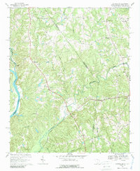
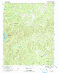
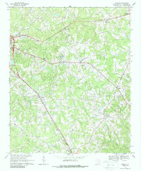
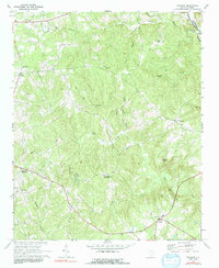
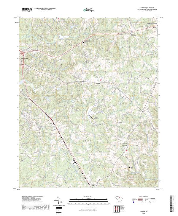
Antioch and the surrounding South Carolina countryside are defined by a network of drainage basins and family-named landmarks east of the city of Lancaster. The landscape is dominated by the tributaries of Gills Creek, Bear Creek, and Turkey Quarter Creek, which separate small settlements like Rich Hill Crossroads and Primus. For those researching local history or genealogy, the map provides precise locations for several burial sites and houses of worship, including Oak Ridge ARP Church and its associated cemetery, alongside older grounds such as the Hopewell Church Graveyard and Caskey Cem. The presence of the Kirk Air Base Airport near the center of the sheet highlights the integration of aviation infrastructure within this traditionally agricultural and residential terrain. Many of the local roads, such as Old Dixie Rd and Old Camden Rd, trace established routes connecting these rural hamlets to the regional hub at Elgin.
Find a feature on this map
178 named features on this map. Tap any name to fly to it.
Don’t see what you’re looking for? This feature index may not catch every label — zoom into the map to look around manually.
Map Details
Editions of this 2024 Antioch Map
This is the sole edition of this map. No revisions or reprints were ever made.
Historical Maps of Elgin Through Time
8 maps found