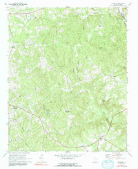
1969 Map of Taxahaw
USGS Topo · Published 1991About this map
The Lynches River forms a natural eastern boundary for this rural section of Lancaster and Chesterfield counties, where small crossroads communities and country parishes define the landscape. Surveyed in the late 1960s, the map reveals a network of local centers like Taxahaw, Buford, and Midway, many established at key intersections and high ground above the drainage basins of Flat Creek and Turkey Creek. One of the most distinctive natural landmarks is 40 Acre Rock, a massive granite outcropping that stands out amidst the dense woodland and creek branches.
Find a feature on this map
33 named features on this map. Tap any name to fly to it.
Don’t see what you’re looking for? This feature index may not catch every label — zoom into the map to look around manually.
Map Details
Editions of this 1969 Taxahaw Map
2 editions found
Other maps of this area

1941 · Spartanburg
USGS Topo · 1:250,000

1953 · Spartanburg
USGS Topo · 1:250,000

1960 · Spartanburg
USGS Topo · 1:250,000

1963 · Spartanburg
USGS Topo · 1:250,000

1964 · Spartanburg
USGS Topo · 1:250,000

1967 · Mount Pisgah
USGS Topo · 1:24,000

1968 · Heath Springs
USGS Topo · 1:24,000

1968 · Jefferson
USGS Topo · 1:24,000
1969 · Kershaw
USGS Topo · 1:24,000

1969 · Antioch
USGS Topo · 1:24,000