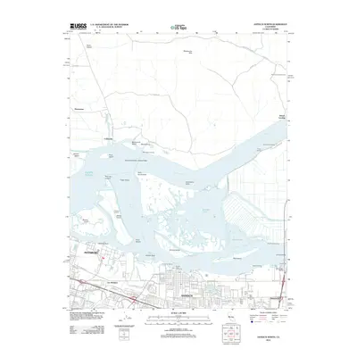
2012 Map of Antioch North
USGS Topo · Published 2012About this map
The Sacramento-San Joaquin Delta serves as the dominant geographical feature of this 2012 survey, where the Sacramento River and San Joaquin River converge amid a complex network of islands and sloughs. Historically significant waterfronts are well represented, from the industrial character of Pittsburg and Antioch to smaller riverfront outposts like Collinsville and Montezuma Landing. The map illustrates a landscape shaped by both natural hydrology and human utility, featuring the Sherman Island Gas Field and the Mokelumne Aqueduct infrastructure.
Find a feature on this map
129 named features on this map. Tap any name to fly to it.
Don’t see what you’re looking for? This feature index may not catch every label — zoom into the map to look around manually.
Map Details
Editions of this 2012 Antioch North Map
This is the sole edition of this map. No revisions or reprints were ever made.
Other maps of this area

1896 · Mt. Diablo
USGS Topo · 1:62,500

1898 · Mt. Diablo
USGS Topo · 1:62,500

1907 · Antioch
USGS Topo · 1:62,500

1908 · Antioch
USGS Topo · 1:62,500

1910 · Rio Vista
USGS Topo · 1:31,680

1910 · Jersey
USGS Topo · 1:31,680

1914 · Brentwood
USGS Topo · 1:31,680

1916 · Lone Tree Valley
USGS Topo · 1:31,680

1916 · Byron
USGS Topo · 1:62,500

1918 · Honker Bay
USGS Topo · 1:31,680