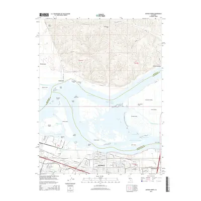
2015 Map of Antioch North
USGS Topo · Published 2015About this map
Sherman Island and the complex waterways of the California Delta dominate this landscape where the Sacramento River meets the San Joaquin River. The topography transitions from the low-lying wetlands and islands of the Central Valley to the modest elevations of the Montezuma Hills in the north. The city of Antioch serves as the primary urban anchor along the southern shore, showing a developed grid and several memorial sites, including Holly Cross Cemetery and Oak View Memorial Park.
Find a feature on this map
121 named features on this map. Tap any name to fly to it.
Don’t see what you’re looking for? This feature index may not catch every label — zoom into the map to look around manually.
Map Details
Editions of this 2015 Antioch North Map
This is the sole edition of this map. No revisions or reprints were ever made.
Other maps of this area

1896 · Mt. Diablo
USGS Topo · 1:62,500

1898 · Mt. Diablo
USGS Topo · 1:62,500

1907 · Antioch
USGS Topo · 1:62,500

1908 · Antioch
USGS Topo · 1:62,500

1910 · Rio Vista
USGS Topo · 1:31,680

1910 · Jersey
USGS Topo · 1:31,680

1914 · Brentwood
USGS Topo · 1:31,680

1916 · Lone Tree Valley
USGS Topo · 1:31,680

1916 · Byron
USGS Topo · 1:62,500

1918 · Honker Bay
USGS Topo · 1:31,680