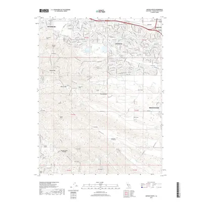
2018 Map of Antioch South
USGS Topo · Published 2018About this map
The northern reaches of the Diablo Range meet the edge of the San Joaquin Valley in this 2018 survey, documenting a region defined by its industrial past and suburban present. Notable remnants of early coal mining operations are visible in the hills south of Antioch, particularly the Coal Mine Tunnels and the sites of former mining communities like Somersville, Stewartville, and West Hartley. These settlements, along with Rose Hill Cem, provide a spatial record of the Mount Diablo Coalfield's nineteenth-century heyday.
Find a feature on this map
231 named features on this map. Tap any name to fly to it.
Don’t see what you’re looking for? This feature index may not catch every label — zoom into the map to look around manually.
Map Details
Editions of this 2018 Antioch South Map
This is the sole edition of this map. No revisions or reprints were ever made.
Other maps of this area

1896 · Mt. Diablo
USGS Topo · 1:62,500

1898 · Mt. Diablo
USGS Topo · 1:62,500

1907 · Antioch
USGS Topo · 1:62,500

1908 · Antioch
USGS Topo · 1:62,500

1910 · Jersey
USGS Topo · 1:31,680

1911 · Byron Hot Springs
USGS Topo · 1:31,680

1914 · Brentwood
USGS Topo · 1:31,680

1916 · Lone Tree Valley
USGS Topo · 1:31,680

1916 · Byron Hot Springs
USGS Topo · 1:31,680

1916 · Byron
USGS Topo · 1:62,500