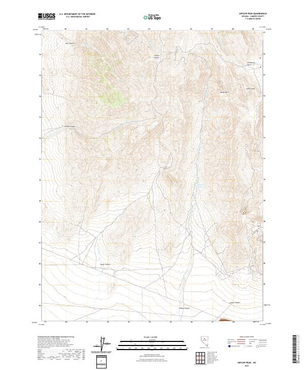
2021 Map of Antler Peak
USGS Topo · Published 2021About this map
Antler Peak and the surrounding high ground of Battle Mtn dominate this 2021 landscape in Lander County. The topography is defined by a series of significant drainages, including Mill Canyon and Trenton Canyon to the north, and Rocky Canyon and Willow Canyon further south. These features illustrate the complex watershed of the region, where seasonal flows like Mill Cr and Rock Cr cut through the arid terrain.
Find a feature on this map
22 named features on this map. Tap any name to fly to it.
Don’t see what you’re looking for? This feature index may not catch every label — zoom into the map to look around manually.
Map Details
Editions of this 2021 Antler Peak Map
This is the sole edition of this map. No revisions or reprints were ever made.
Other maps of this area

1932 · Sonoma Range
USGS Topo · 1:250,000

1939 · Sonoma Range
USGS Topo · 1:250,000

1940 · Antler Peak
USGS Topo · 1:62,500

1943 · Antler Peak
USGS Topo · 1:62,500

1955 · Winnemucca
USGS Topo · 1:250,000

1958 · Winnemucca
USGS Topo · 1:250,000

1961 · McCoy
USGS Topo · 1:62,500

1962 · Winnemucca
USGS Topo · 1:250,000

1962 · Buffalo Springs
USGS Topo · 1:62,500
1965 · Cherry Creek NE
USGS Topo · 1:24,000