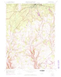
1946 Map of Antrim
USGS Topo · Published 1972About this map
Wellsboro serves as the northern anchor for this Tioga County landscape, where the plateau transitions into the steep drainages of Wilson Creek and Stony Fork. The topography is defined by prominent family-named heights like Russell Hill, Shumway Hill, and Dean Hill, reflecting a long history of upland farming and settlement. To the southeast, the village of Antrim marks a distinct cluster of activity, while smaller hamlets such as Balsam and Draper are scattered across the township boundaries of Delmar and Charleston.
Find a feature on this map
41 named features on this map. Tap any name to fly to it.
Don’t see what you’re looking for? This feature index may not catch every label — zoom into the map to look around manually.
Map Details
Editions of this 1946 Antrim Map
5 editions found
Other maps of this area

1900 · Tioga
USGS Topo · 1:62,500

1900 · Elkland
USGS Topo · 1:62,500

1902 · Tioga
USGS Topo · 1:62,500

1925 · Blossburg
USGS Topo · 1:62,500

1927 · Blossburg
USGS Topo · 1:62,500

1944 · Blossburg
USGS Topo · 1:62,500

1946 · Tiadaghton
USGS Topo · 1:24,000

1946 · Antrim
USGS Topo · 1:62,500

1946 · Cedar Run
USGS Topo · 1:24,000

1946 · Antrim
USGS Topo · 1:24,000
Featured Places
- Wellsboro, PA
- Morris Township, PA
- Duncan Township, PA
- Stony Fork, Delmar Township
- Pitts, Charleston Township