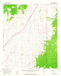
1958 Map of Apache
USGS Topo · Published 1963About this map
The Geronimo Surrender Site stands as a focal point of this borderlands landscape, marking a pivotal transition in the American West near the Skeleton Canyon drainage. Located where the Chiricahua Mountains meet the Peloncillo Mountains, the map documents a region defined by high-desert ranching and historic travel routes. The Southern Pacific railroad line cuts through the San Bernardino Valley, passing the settlement of Apache and its nearby Apache Cemetery. To the south and east, the terrain becomes increasingly complex, with family-named holdings like Sloan Ranch and Fairchild Ranch situated near the rugged canyons and the Coronado National Forest boundary. Geologic curiosities such as Paramore Crater and Red Hill punctuate the valley floor, while the Geronimo Trail winds through the southern reaches, tracing the path of earlier migrations and military history.
Find a feature on this map
52 named features on this map. Tap any name to fly to it.
Don’t see what you’re looking for? This feature index may not catch every label — zoom into the map to look around manually.
Map Details
Editions of this 1958 Apache Map
3 editions found

Other maps of this area

1917 · Chiricahua
USGS Topo · 1:125,000

1918 · Cienega Springs
USGS Topo · 1:62,500

1918 · Animas Peak
USGS Topo · 1:62,500

1918 · Pratt
USGS Topo · 1:62,500

1919 · Pratt
USGS Topo · 1:62,500

1919 · Perilla
USGS Topo · 1:125,000

1919 · Chiricahua
USGS Topo · 1:125,000

1920 · Animas Peak
USGS Topo · 1:62,500

1922 · McDonald
USGS Topo · 1:62,500

1926 · Rodeo
USGS Topo · 1:62,500