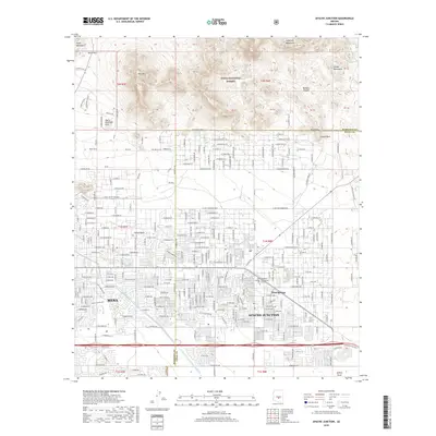
2018 Map of Apache Junction
USGS Topo · Published 2018About this map
Apache Junction and the eastern edge of Mesa define this 2018 landscape, where suburban expansion meets the desert mountains of the Tonto National Forest. The map documents a highly developed grid of residential streets and mobile home parks that transition into the protected slopes of the Usery Mountains and the Goldfield Mountains. A critical piece of modern infrastructure, the Central Arizona Project Aqueduct, cuts across the terrain, illustrating the engineering required to sustain these desert communities. The area is marked by several distinct peaks and ridges including Signal Butte, Pass Mtn, and Saddle Rock. Local education and recreation are anchored by the Central Arizona College - Superstition Mtn Campus and the extensive trail systems within Usery Mountain Park, while drainage features like Weekes Wash and Bulldog Wash manage seasonal runoff through the developed corridor.
Find a feature on this map
101 named features on this map. Tap any name to fly to it.
Don’t see what you’re looking for? This feature index may not catch every label — zoom into the map to look around manually.
Map Details
Editions of this 2018 Apache Junction Map
This is the sole edition of this map. No revisions or reprints were ever made.
Other maps of this area

1900 · Florence
USGS Topo · 1:125,000

1902 · Florence
USGS Topo · 1:125,000

1904 · Desert Well
USGS Topo · 1:62,500

1904 · Ft. McDowell
USGS Topo · 1:62,500

1906 · Ft. McDowell
USGS Topo · 1:62,500

1906 · Desert Well
USGS Topo · 1:62,500

1907 · Roosevelt
USGS Topo · 1:125,000

1909 · Four Peaks
USGS Topo · 1:125,000

1912 · Roosevelt
USGS Topo · 1:125,000

1930 · Cave Creek
USGS Topo · 1:125,000