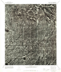
1971 Map of Apache Junction
USGS Topo · Published 1972About this map
Apache Junction occupies the heart of this 1971 orthophotomosaic, appearing as a developing grid of streets and structures at the base of dramatic, high-contrast desert terrain. This aerial perspective, captured by the U.S. Geological Survey using photogrammetric methods, reveals the literal footprint of the community before decades of further expansion. The imagery highlights the sharp division between the organized residential and commercial blocks along the main thoroughfares and the intricate, branching drainage patterns of the desert floor to the north. Unlike traditional line maps, this photographic study provides a direct look at the density of vegetation and the specific layout of early desert subdivisions as they integrated into the Pinal and Maricopa County landscapes during the early 1970s.
Find a feature on this map
1 named feature on this map. Tap any name to fly to it.
Don’t see what you’re looking for? This feature index may not catch every label — zoom into the map to look around manually.
Map Details
Editions of this 1971 Apache Junction Map
This is the sole edition of this map. No revisions or reprints were ever made.
Other maps of this area

1900 · Florence
USGS Topo · 1:125,000

1902 · Florence
USGS Topo · 1:125,000

1904 · Desert Well
USGS Topo · 1:62,500

1904 · Ft. McDowell
USGS Topo · 1:62,500

1906 · Ft. McDowell
USGS Topo · 1:62,500

1906 · Desert Well
USGS Topo · 1:62,500

1907 · Roosevelt
USGS Topo · 1:125,000

1909 · Four Peaks
USGS Topo · 1:125,000

1912 · Roosevelt
USGS Topo · 1:125,000

1930 · Cave Creek
USGS Topo · 1:125,000