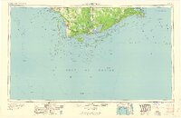
1960 Map of Apalachicola
USGS Topo · Published 1960About this map
The Apalachicola River flows into the expansive Apalachicola Bay, anchoring a coastal landscape defined by barrier islands and extensive wetlands. During this mid-century period, the Apalachicola Northern railroad links the maritime hubs of Apalachicola and Port St Joe, facilitating a regional economy tied to the sea and the timber of the Apalachicola National Forest. Significant civil works are visible, including the John Gorrie Memorial Bridge connecting the mainland to Eastpoint.
Find a feature on this map
84 named features on this map. Tap any name to fly to it.
Don’t see what you’re looking for? This feature index may not catch every label — zoom into the map to look around manually.
Map Details
Editions of this 1960 Apalachicola Map
This is the sole edition of this map. No revisions or reprints were ever made.
Other maps of this area

1940 · Arran
USGS Topo · 1:62,500

1943 · Arran
USGS Topo · 1:62,500

1943 · St Joseph Spit
USGS Topo · 1:31,680

1943 · Beacon Beach
USGS Topo · 1:31,680

1943 · Port St. Joe
USGS Topo · 1:31,680

1943 · Cape San Blas
USGS Topo · 1:31,680

1943 · Dog Island
USGS Topo · 1:31,680

1943 · West Pass
USGS Topo · 1:31,680

1943 · Overstreet
USGS Topo · 1:31,680

1943 · Apalachicola
USGS Topo · 1:31,680