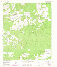
1963 Map of Apple Springs
USGS Topo · Published 1980About this map
The Davy Crockett National Forest dominates this East Texas landscape, where dense woodland is punctuated by small settlements and a winding network of creeks. In the north, the community of Apple Springs serves as a local hub near the Angelina and Trinity county line. Further east, the settlement of Nigton sits near the headwaters of West Mark Branch. The terrain is characterized by numerous drainage systems including Hackberry Creek, Sandy Creek, and Alabama Creek, reflecting the importance of water resources to the region's historical development.
Find a feature on this map
26 named features on this map. Tap any name to fly to it.
Don’t see what you’re looking for? This feature index may not catch every label — zoom into the map to look around manually.
Map Details
Editions of this 1963 Apple Springs Map
2 editions found
Other maps of this area

1949 · Keltys
USGS Topo · 1:24,000

1950 · Keltys
USGS Topo · 1:24,000

1950 · Centralia
USGS Topo · 1:24,000

1951 · Wells SW
USGS Topo · 1:24,000

1951 · Centralia
USGS Topo · 1:24,000

1953 · Palestine
USGS Topo · 1:250,000

1957 · Palestine
USGS Topo · 1:250,000

1963 · Crecy
USGS Topo · 1:24,000

1963 · Groveton East
USGS Topo · 1:24,000
1963 · Apple Springs
USGS Topo · 1:24,000