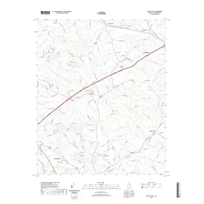
2020 Map of Apple Valley
USGS Topo · Published 2020About this map
The North Oconee River winds through this section of Jackson County, anchoring a landscape where agricultural roots and modern infrastructure intersect. The county seat of Jefferson sits in the southwest, marked by the Jackson County Courthouse, while the growing industrial and transit corridors of Commerce and Maysville occupy the northeastern reaches. This 2020 record captures the persistence of early rural communities like Thyatira, Apple Valley, and Dry Pond, which remain identifiable through their namesake cemeteries and churches.
Find a feature on this map
163 named features on this map. Tap any name to fly to it.
Don’t see what you’re looking for? This feature index may not catch every label — zoom into the map to look around manually.
Map Details
Editions of this 2020 Apple Valley Map
This is the sole edition of this map. No revisions or reprints were ever made.
Other maps of this area

1891 · Gainesville
USGS Topo · 1:125,000

1891 · Carnesville
USGS Topo · 1:125,000

1954 · Greenville
USGS Topo · 1:250,000

1958 · Greenville
USGS Topo · 1:250,000

1964 · Commerce
USGS Topo · 1:24,000

1964 · Maysville
USGS Topo · 1:24,000
1964 · Winder North
USGS Topo · 1:24,000
1964 · Nicholson
USGS Topo · 1:24,000

1964 · Pendergrass
USGS Topo · 1:24,000
1964 · Jefferson
USGS Topo · 1:24,000